Experience
The content of this section was provided by the Love Saltash magazine. The original Love Saltash article can be downloaded here.
Picture Yourself
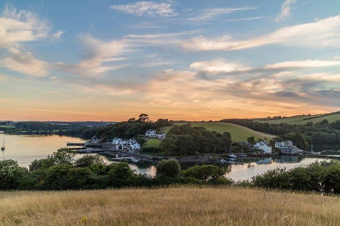
You are standing on the top of a perfect childhood hill, one of those round even ones that drops away with pleasingly even proportions…
Around you, in all directions, are far-reaching as well as close range dramatic views – layers of fields envelop you from behind, and to your right a dramatic drop down to the mill pond of Antony’s Passage can be seen.
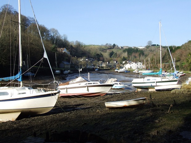
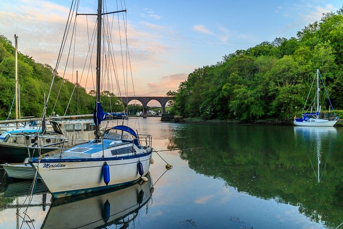
Framed by the viaduct and the rustic crenels of Trematon Castle protruding from the greenery, the mainly still and reflective waters lead to Forder village.
Scan left a few degrees and the eye is led up the estuary, with all its inlets and its two architectural gems, Antony House (out of view itself, but the beautiful approach to it is visible) and Ince Castle to the right, framing a view to the calm waters upstream.
If you strain your eyes to the horizon, you can just make out some tiny clusters of dolls-house-scale residences, which on a fair day it is possible to see belong to the coastal village of Crafthole and surrounding hamlets.
Scan straight ahead now, and there is a narrow stretch of the tidal estuary opening into the busy sprawl of Devonport Dockyard, the to-ing and fro-ing of Torpoint ferries, with the blurred urban greyness of the city stretching out behind.
Where are you?
There is no other place you could be in Saltash – Churchtown Farm Community Nature Reserve. The striking level of contrast sums up why living in Saltash offers the best of everything… a city across the bridge, an expanse of coast and villages only a few minutes away, and castles and stunning gardens and grounds only a stone’s throw from this viewpoint on a perfectly round hill embraced by patchwork fields. What more could you want?!
With an active and passionate Friends’ Group, the reserve has thrived in recent years under the management of Cornwall Wildlife Trust.
By reintroducing more traditional Cornish farming methods to the third biggest reserve they own (at 61 hectares), a wider range of wildlife and plant species has been encouraged to return to and flourish in this natural asset within the Tamar Valley Area of Outstanding Natural Beauty (AONB).
Positioned between the rivers Tamar and Lynher as well as Forder Creek, the majority of the reserve is farmland and includes diverse habitats such as grassland, estuarine mudflats, wetland, woodland, disused quarries and hedgerows. There are many ways to enjoy and explore the beautiful natural diversity of the reserve – here are just a few…
Birds
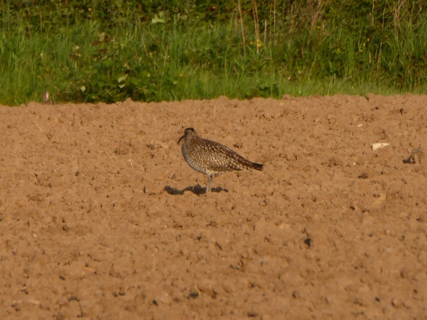
Up on the reserve, many species of bird can be spotted. From far up in the sky, birds of prey circle over small creatures in the bushes, pausing before descending at speed. Skylarks find a natural nesting environment here, which triggered an awareness campaign a little while back to prevent dogs off leads scaring this endangered bird species out of their space.
At sunset, Swifts and Swallows with their forked tails can be seen dipping and diving over and through bushes and shrubbery just before the railway bridge. Down at the crescent-shaped beach at low tide Oystercatchers, Dunlins, Egrets, Avocets and Greenshank can all be seen on the mudflats, so get down and see what you can spot.
Photograph what you see then check back at home with this guide: Link to RSPB.
Foraging
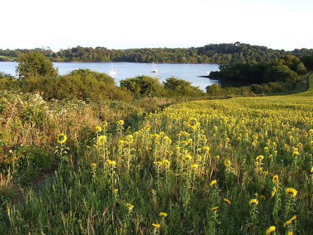
Food really does taste better when it’s free, and there are many types to be found at the reserve if you know what you’re looking for… The obvious Autumnal fayre includes blackberries and sloes – perfect for crumbles and beautiful fruity gin. The less obvious items include sea beet (Beta Maritima), which can be found at the lower areas of the reserve – otherwise known as Wild Spinach, which is delicious raw or cooked and is a thicker and meatier version of the shop-bought leaf.
Various types of funghi can be found – but this is not an area for guesswork so always take an expert with you and check www.wildaboutbritain.co.uk/ british/Fungi/identification before anything goes near your mouth! There are many innocuous food items up for grabs though, from beech and hazel nuts for nibbling and chestnuts for roasting to garlic flowers for fragrant salads… Here’s a guide to help you know what to look out for: link to Wild Food UK.
Photography
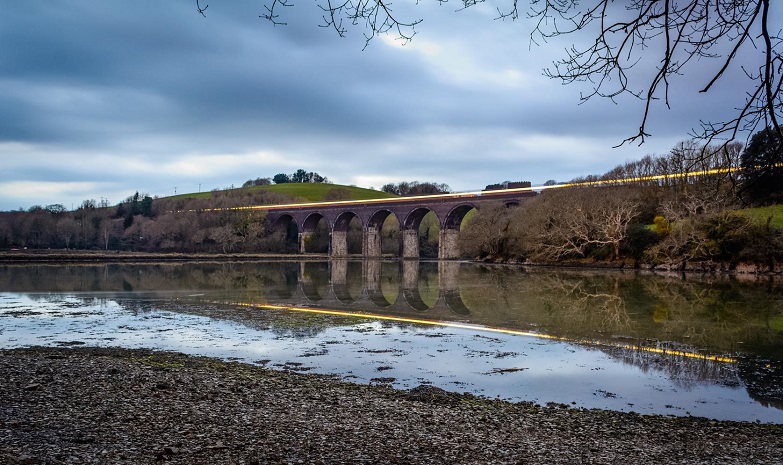
Churchtown Reserve is a favourite destination for local photographers, both amateur and professional. Its position means that there is usually a scenic opportunity in one of many directions, depending on the light and weather conditions. Whether it’s panoramic views and landscapes you’re looking for, or wildlife actions shots, or close ups of flowers and plants, the reserve is a stimulating place for capturing images…
Oh, and the sunsets! Churchtown is known for its dramatic and often luminous colourscapes, ranging from hot oranges through to cool yellows and blues. Take a look at the Churchtown Farm Friends Facebook page for inspiration, or simply take off with your own camera and see what you can find. Take a look at this website page to arm yourself with some top tips: Link to discover wildlife
Walks
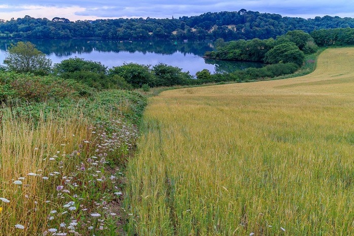
Churchtown is a hugely popular dog-walking spot, with plenty of space to run off energy, chase sticks and even cool down with a plunge in the water at the bottom of the reserve. It’s just as useful a place for running off children’s energy too – and there are some mean sledging hills when conditions are right.
Walking for relaxation and wellbeing is also a valuable activity – the exercise, along with the meditative quality of walking, enables you to leave the worries and hecticness of day-to-day life behind you, immerse yourself in nature, take in the views… and… breee-athe… Aah. If you’d rather not take the spontaneous approach, there are some planned out walks taking in Churchtown Reserve on the Saltash Town Council Website, take a look at: Link to walks in saltash
Geology
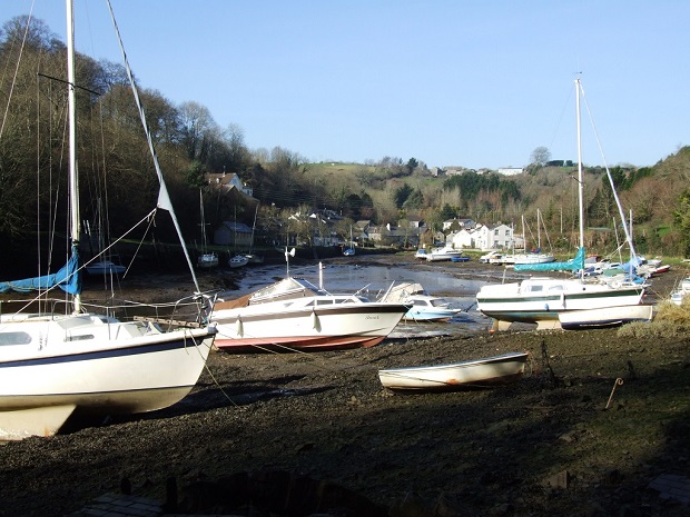
There are interesting rock formations across Churchtown Reserve, especially around the Forder Creek area. The two disused quarries in the reserve, Forder and Lowhill, are now County Geological Sites. Both were quarried in the 19th century for roadstone, and it was hornblende dolerite that was used from these sites in road construction. You can discover far more about the physical features of Churchtown at the upcoming Geology event organised by Friends of Churchtown Farm Community Nature Reserve.
This sociable and educational walk is on Saturday 12 March, from 10.30am until 1.30pm (meet at Cecil Arms by St Stephen’s Church). The event is free for Friends of Churchtown, £1 for Cornwall Wildlife Trust members, and £2 for non-members. Bring a camera and binoculars, if you have them, and wear sturdy shoes. For more information contact Mary Langworth on (01752) 843852.
